


|
|
| Radar/Satellite images courtesy of NOAA/NWS and Weather Underground. | |
| Updated: @ 07-Jul-2026 8:48am - next update at 8:50am | |||||||||||||||||||||||||||||||||||||||
| Summary / Temperature | Wind | Rain | Outlook | ||||||||||||||||||||||||||||||||||||
|
|
|
|
||||||||||||||||||||||||||||||||||||
| Humidity & Barometer | Almanac | Moon | |||||||||||||||||||||||||||||||||||||
|
|
|
|||||||||||||||||||||||||||||||||||||
| UV Index Forecast | UV Index Forecast | ||||||||||||||||||||||||||||||||||||||
|
|
||||||||||||||||||||||||||||||||||||||


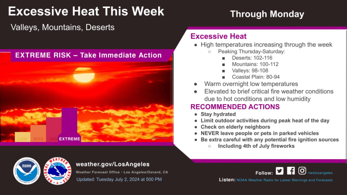
| NWS Weather Forecast - Outlook: Today & Tonight | ||||||
|
||||||

| Countdown to Fall | ||
|